
Route points
The points that make up the route can be simple positions and can be points “filled” with some event. An event can be e.g. the start, stop, or virtually any change in condition of the vehicle that is detected by a sensor and sent to the control panel by the GPS device. After querying a route, the system provides information about it in two places: on the map (drawing) and in the Events panel.
Point information on the map
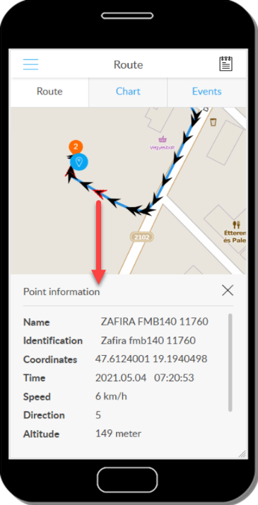
If you press and hold a point on the map (event or position marker) on the map, an information panel will appear with the relevant details of the point.
Meaning of points
In the panel, the route is described by waiting points, the sections between them, and related information. Because a route is a trip in a specified time interval, the start and end points (First data, Last data) are not necessarily linked to an event - they indicate the map points that are closest to the beginning and end of the period, respectively.
There are waiting points and travel sections between the start and end points. Waiting points are points where the vehicle is parked.
If the Point information option is turned on during the query, in addition to the waiting points, the system will display all the points (arrows on the route) from which the GPS device has sent data to the control panel. These are linked to coordinates and some other basic data, and their role is mainly to draw the route as accurately as possible.
The panel can be closed with the X key. If the information panel of a point is open and you press another point, its details are displayed in the panel.
Tracking easily and efficiently


